Happy summer to everyone! Here in Michigan we have been in the grips of quite the heat spell, which was especially brutal over the week of the fourth of July. As the house Luke and I were living in didn’t have air conditioning we decided to escape north during that week to avoid the steamy temperatures. Earlier in the year Luke and I had a vague trip in mind to drive around Lake Superior, however the time we had allotted for this extended weekend would not allow for the full road trip so we compromised by heading as far north as Wawa, Ontario, Canada before retracing our drive back home.
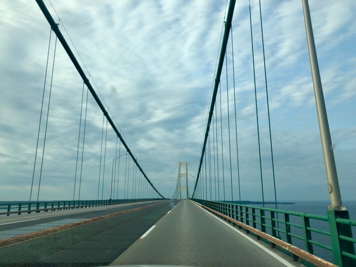
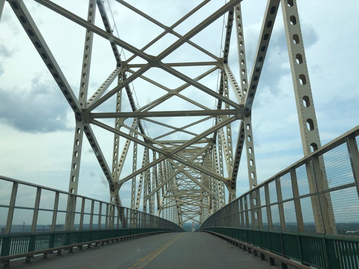
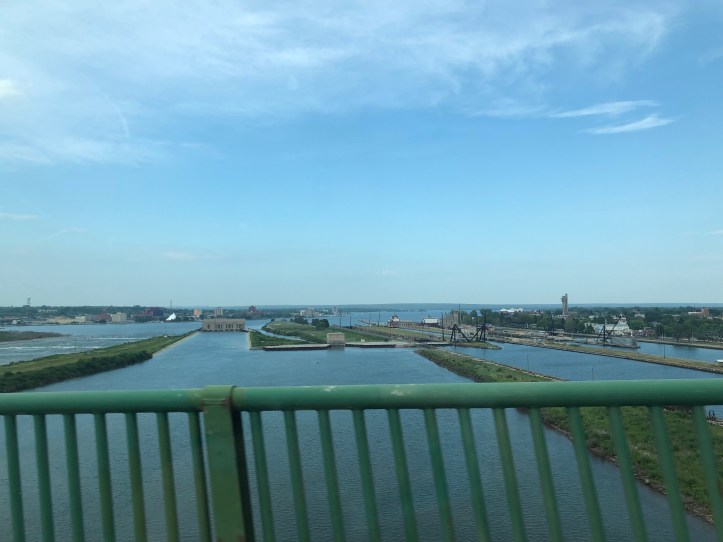
Driving north from the Lower Peninsula, you have to first cross the iconic Mackinac Bridge that connects Michigan’s two halves. We stayed a few days with friends at the Les Cheneaux Islands near Cedarville, Michigan, which is truly a hidden gem in my biasly favorite state. After disembarking from Island 8 to continue our trek north we crossed into Canada at Sault Ste Marie before heading toward Wawa. Below you’ll find the image of the Sault Ste Marie International Bridge and the fascinating Soo Locks as viewed from the bridge. Can you spot the massive barge going through the far Locks?
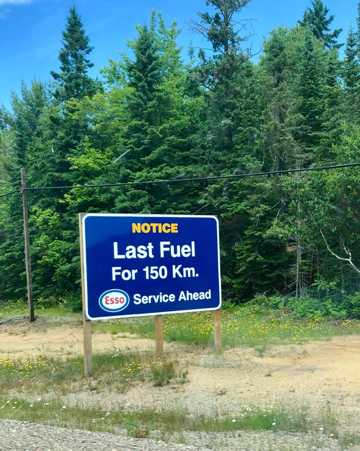
In between Wawa and crossing the border from Michigan at Sault Ste Marie you drive 52 miles through the stunning Lake Superior Provincial Park. A gauge of how remote this park was is the following sign that warns drivers that the next gas station would be 152 km! I couldn’t help but wonder how many drivers neglect this warning and end up stranded.
The park itself was a beautiful drive, where each bend afforded even more breathtaking views. My favorite part of the drive had to be the stretch where the road wound along Lake Superior.
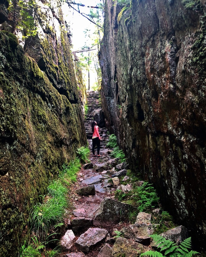
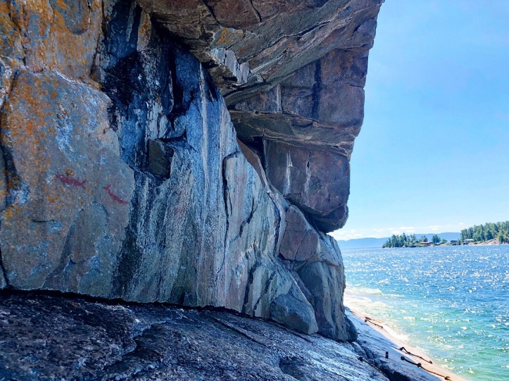
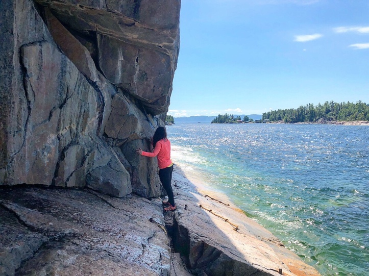
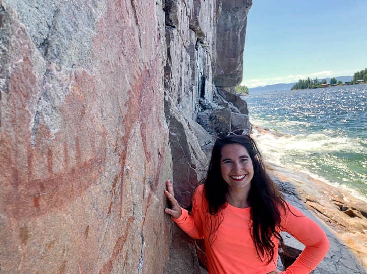
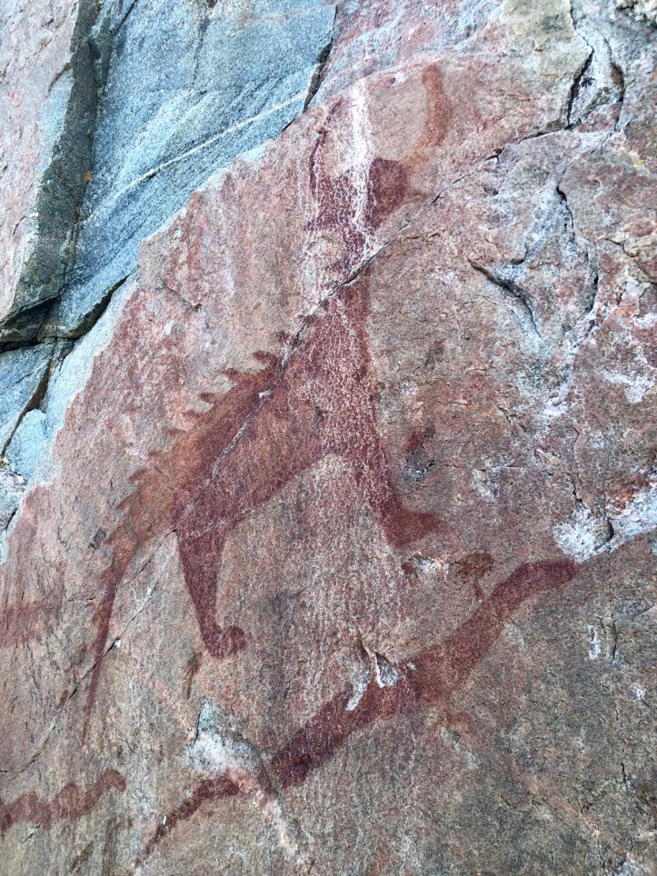
Agawa Rock Pictographs
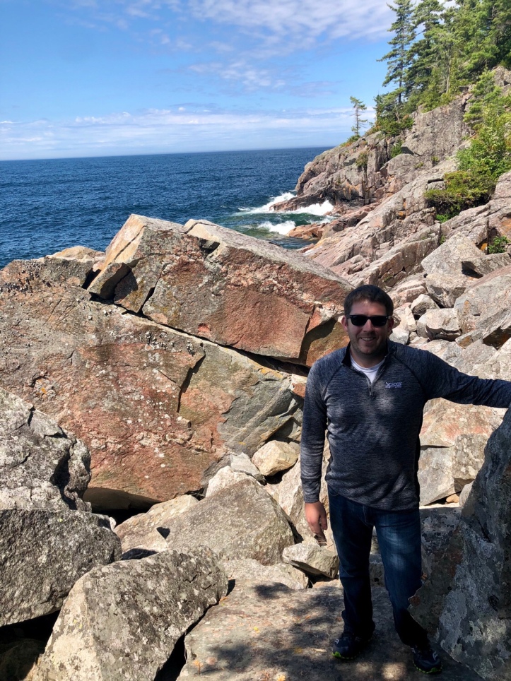
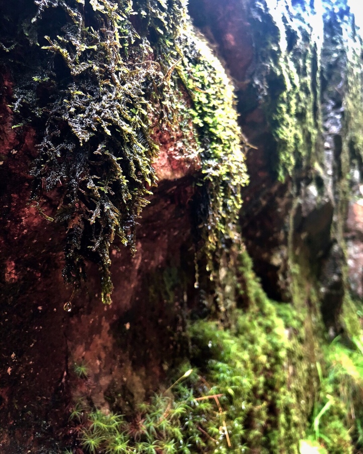
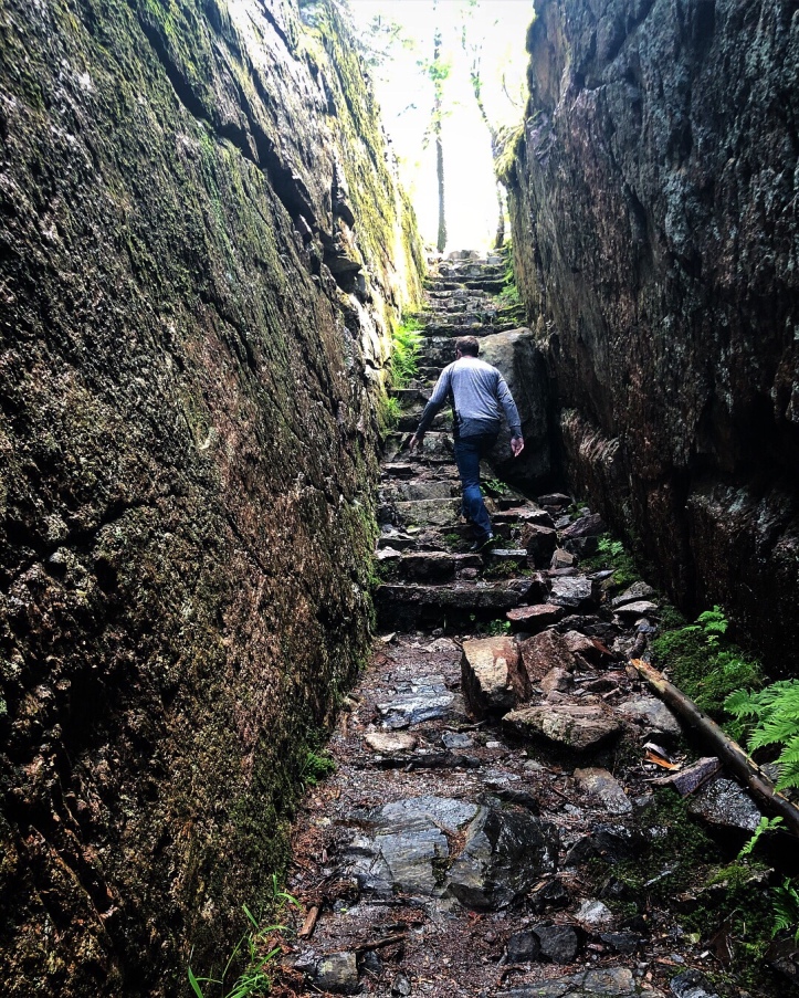
Our first stop in the park was the Agawa Rock Pictographs that was a relatively easy 500 m hike to the Lake Superior shore. From here though it became one of the most unnerving hikes I’ve attempted. A friend’s father recommended this hike and we are so thankful he did because it was well worth the adrenaline, cliff side clinging shuffle to view the ancient pictographs. In the photos along the water edge can you identify the ropes that are hanging near the water? Our best guess is that they are there if people fall in. The waves were uncomfortably big as Luke and I waited our turn to shuffle along the edge. Don’t tell him that I’m confessing this to you but he was a bundle of nerves as we made our way out to the main iconic image. It didn’t help that a Grandpa and his little Grandson followed us out, essentially blocking our way back. There’s no turn around point or easy way to switch spots so we had to scrunch together while the duo got a glimpse of the key animal before we all could head back to dry land. As a result, when two especially large waves came in, Luke and I got soaked to the knees as we clung to the cliff face. Thankfully the little boy was on a slightly higher ledge so he didn’t get caught up in the wave. Needless to say, as amazing as the 2000 year old images were, we were very ready to get back to the viewing platform. We couldn’t believe it when over ten people proceeded to make their way out to the cliff edge after we vacated the tightrope. Regardless, we could have spent significantly more time soaking in every little detail of the pictographs if Gitchi Gami had been a bit tamer that day.

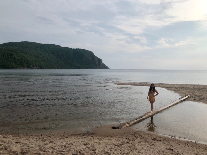
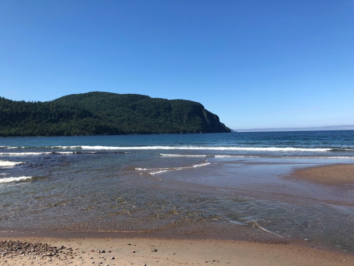
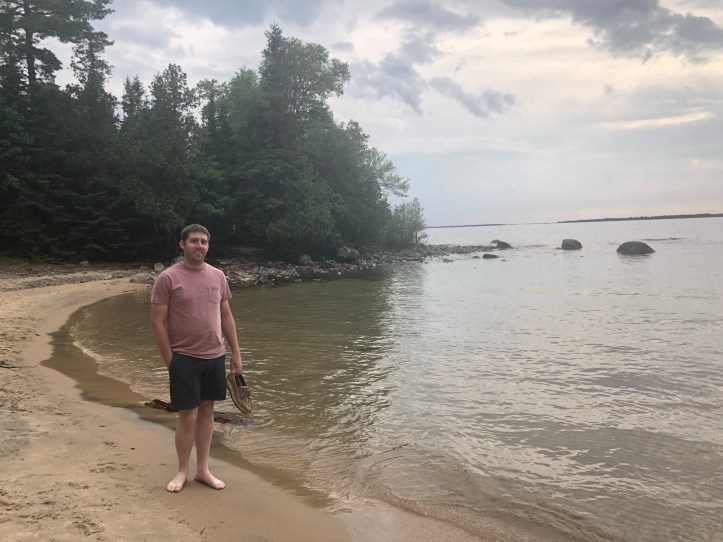
Old Woman Bay
After the pictographs we stopped at Old Woman Bay based on a glowing recommendation from Luke’s boss. This stunning bay looked as though it could be the backdrop of a movie with the towering green cliffs in the background. Had we more time I would have loved perusing the hikes through this area. I loved this area so much that we stopped back by on our way south the next day. You can see the view from the sunny second morning after a storm blew through over night. The log that was so conveniently positioned for a quick photo op the night before could be found yards away, significantly high up on the beach.
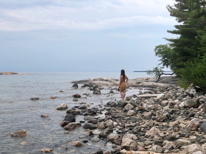
Katherine Cove
Our last stop before Wawa was Katherine Cove where we stuck our feet in the icy Lake Superior. This beautiful little spot contained two beaches separated by a wooded peninsula. Due to this trip being relatively spur of the moment we hadn’t read a lot of literature regarding this specific park and what hikes we should adventure to so with our cell phone service being spotty at best we randomly picked locations to pull off at to explore. I know. Not the most analytical approach and we did miss some spots that in hindsight we would have most definitely explored more such as the Sand River and its many waterfalls, but we enjoyed the random unknown of what we would find at each spot. It was a nice change to the over analyzed, itinerary rich trips I usually pick out. Watch next week for my next post about our twenty four hours in Wawa, Ontario.

Fabulous photographs! Thank you. You really bring back memories. When we left Ontario to drive west to BC we crossed at the Sault Ste. Marie bridge and drove through that beautiful park. Also, we went to Three Fires Lodge Anishnabe ceremonies on the shore of Lake Superior years ago and I remember red clay cliffs and a lake that roared like an ocean. The pictograph you are standing beside is Mishipeshu. Here’s a good article about this creature. https://invocationsiu.wordpress.com/2018/06/01/the-spiritual-power-of-ojibwa-pictographs/
LikeLiked by 1 person
Thank you! ❤ And thank you for the article! I'd meant to look up more about the pictographs and hadn't gotten to it yet! I'm glad you enjoyed this region as much as we did!
LikeLike
Was amused by the Esso sign. When people put such signs up over here it usually signfies a price hike of around 25% above ‘normal’.
LikeLiked by 1 person
So true! The gas there was quite a bit more expensive than other nearby locations.
LikeLiked by 1 person
I love reading your trip posts, thanks for sharing.
LikeLiked by 1 person
Thanks Flora! ❤ I'm so happy you enjoy them!
LikeLike
Gorgeous pictures and scenery! How I wish I lived near such beautiful places!
LikeLiked by 1 person
Oh thank you so much Kacy! I’m sure you do live by beautiful places! 🙂
LikeLike
What another lovely travel post! And delightful pictures.
x The Captain
LikeLiked by 1 person
Thank you Captain! ❤
LikeLiked by 1 person
[…] in finishing posting our trip to Wawa. Last week I highlighted our drive to Wawa through the Lake Superior Provincial Park where we marveled over the stunning Canadian shoreline along this massive Great Lake. Upon finally […]
LikeLike
[…] this week I highlighted our fourth of July adventure in Wawa, Ontario and the Lake Superior Provincial Park. This travel post will be my last detailing this specific trip where Luke and I concluded our road […]
LikeLike
Thanks for sharing and Amazing work!! Please check my blog out and I hope you enjoy what you read!! Thanks again!
LikeLiked by 1 person
Thanks Ashley! I’ll most definitely check out your blog!
LikeLiked by 1 person
Beautiful pics and weather!
Please check my blogs too and spread love!
http://mesmots1987.wordpress.com
LikeLike
[…] Lake Superior Provincial Park, Ontario […]
LikeLike
[…] Lake Superior Provincial Park, Ontario Canada […]
LikeLike